
 Explore the map ↗
United Kingdom
Oakhill Leisure
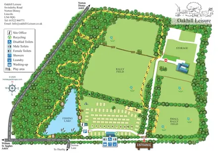
Illustrated Oakhill Leisure map with fishing lake, woodland walks, pitch rows and open rally fields.
THE HOLIDAY PARK MAP COLLECTION
Browse 24 map examples, from Oakhill Leisure to Pen Y Garth Lodge Park.
← Explore the whole collectionCombine a country, landscape, facilities and accommodation type to find relevant examples.
Showing 337–360 of 545 · Select a map to read its story
Explore the map ↗United Kingdom
Illustrated Oakhill Leisure map with fishing lake, woodland walks, pitch rows and open rally fields.
 Explore the map ↗
United Kingdom
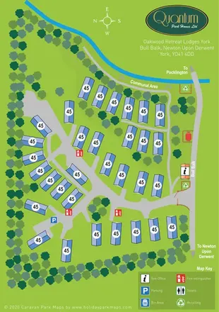
A tree-lined lodge park plan with branching roads, a waterside communal area and a gated entrance from Bull Balk.
 Explore the map ↗
United Kingdom
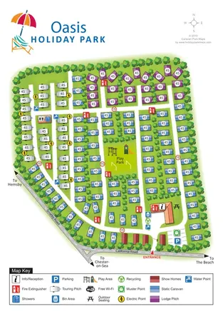
Colour-coded touring, lodge and static-caravan areas around a central play park, with a clearly marked California Road entrance.
 Explore the map ↗
United Kingdom
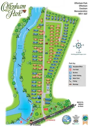
Portrait map of Offenham Park, showing numbered holiday caravans, riverside fishing, moorings and the B4510 entrance.
 Explore the map ↗
United Kingdom
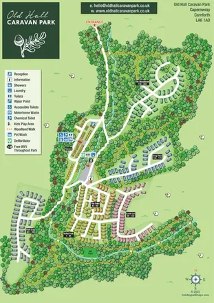
Colour-coded accommodation areas, touring facilities and woodland walks at Old Hall Caravan Park, Capernwray.
 Explore the map ↗
United Kingdom
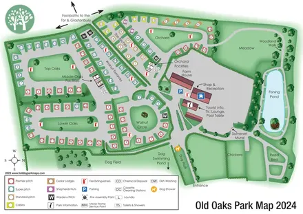
Colour-coded touring and glamping map with hedge-lined pitch groups, a fishing pond and detailed dog facilities.
 Explore the map ↗
United Kingdom
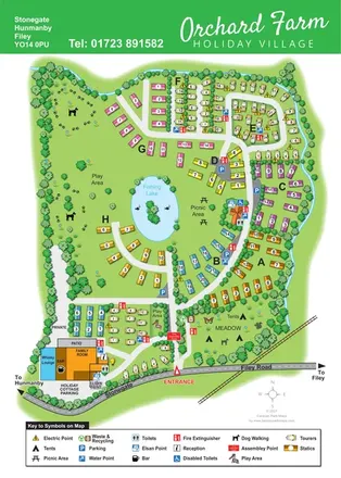
Colour-coded caravan sections, a fishing lake and tent meadow on a tree-lined Hunmanby holiday village map.
 Explore the map ↗
United Kingdom
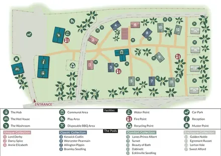
Colour-coded glamping pods, orchard motifs and a two-tier visitor key at Orchard Hideaways.
 Explore the map ↗
United Kingdom
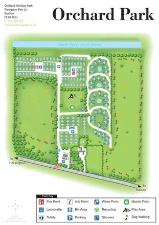
Orchard Holiday Park map with curved accommodation clusters, dog-walking lawns and a named waterside boundary.
 Explore the map ↗
United Kingdom
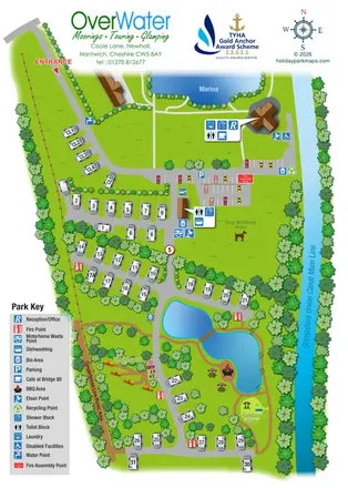
Canal-side touring and wagon glamping map with ponds, picnic paths and grouped facility callouts.
 Explore the map ↗
United Kingdom
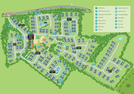
Oyster Bay illustrated park plan with named holiday-home sections, a central leisure hub and dog walking access.
 Explore the map ↗
United Kingdom
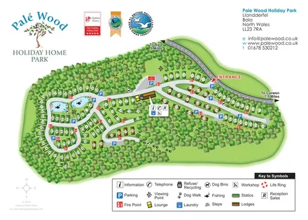
Woodland holiday home map with colour-coded statics and lodges, fishing ponds and branching internal roads.
 Explore the map ↗
United Kingdom
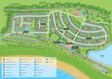
Coastal holiday-park plan with named caravan neighbourhoods, dune paths, leisure facilities and a wildlife lake.
 Explore the map ↗
United Kingdom
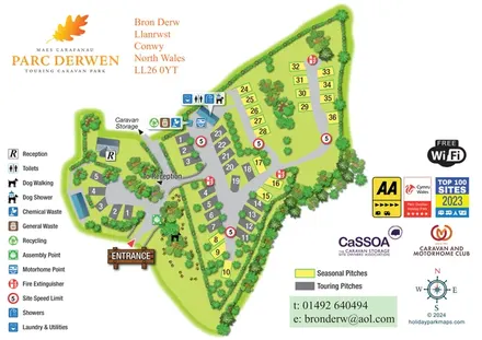
Parc Derwen map with colour-coded pitches, grouped amenity symbols and a paw-print dog-walking area.
 Explore the map ↗
United Kingdom
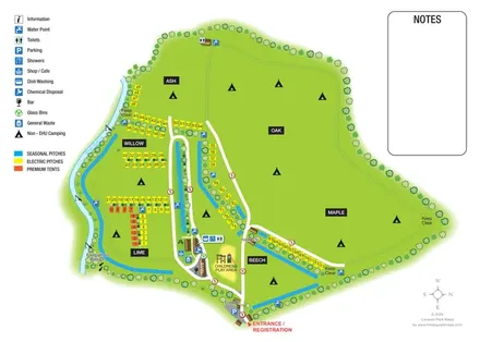
Riverside campsite plan with named fields, colour-coded pitches and a central amenity cluster.
 Explore the map ↗
United Kingdom
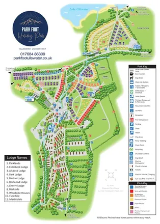
Portrait park map combining colour-coded pitches, static-caravan areas and Ullswater access.
 Explore the map ↗
United Kingdom
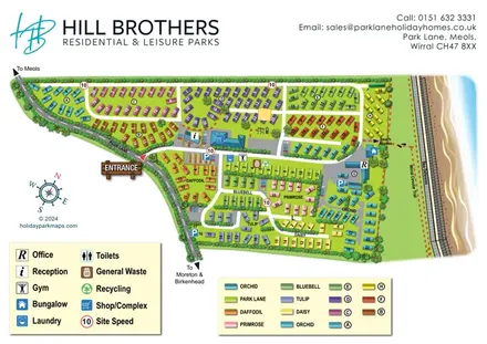
Colour-coded holiday-home neighbourhoods beside the Wirral coast, with facility keys and a marked beach-access route.
 Explore the map ↗
United Kingdom
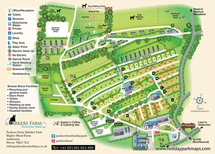
A farm-themed Devon holiday-park map with lettered pitch rows, caravan lanes, animal fields and detailed visitor facilities.
 Explore the map ↗
United Kingdom
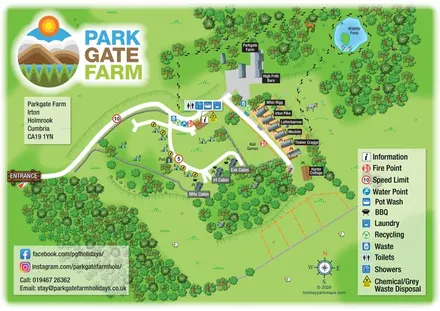
Mixed accommodation, woodland paths and a wildlife pond at Parkgate Farm, Cumbria.
 Explore the map ↗
United Kingdom
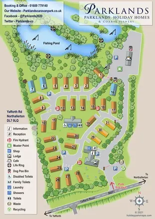
A landscaped holiday-home map with a prominent fishing pond, branching roads and pond-side café.
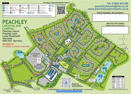 Explore the map ↗
United Kingdom
Tree-named touring areas, electric camping pitches and fishing lakes on an illustrated Peachley Leisure visitor map.
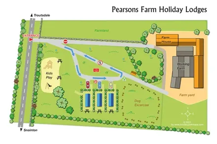 Explore the map ↗
United Kingdom
A compact farm-based lodge map with arrowed access, play space and a paw-print dog exercise area.
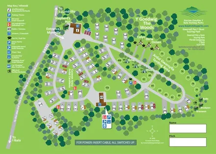 Explore the map ↗
United Kingdom
Bilingual touring, camping and glamping map with woodland, numbered pitches and illustrated amenities.
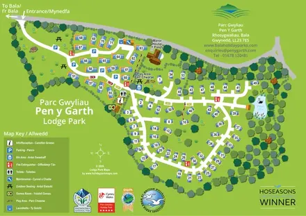 Explore the map ↗
United Kingdom
Bilingual lodge park map with numbered properties, looping roads, woodland planting and a swan pond.
LET’S MAP YOUR PARK
For a map quotation, find your park and draw a rough boundary around it. The area you select helps us work out the design time and price.
Draw your park for a quote ↗Or talk to our map designers
01751 473136