
 Explore the map ↗
United Kingdom
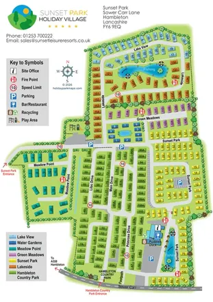
Sunset Park
Colour-coded Sunset Park map with seven neighbourhoods, fishing waters and two named entrances.
THE HOLIDAY PARK MAP COLLECTION
Browse 24 map examples, from Sunset Park to The Trotting Mare Holiday Park.
← Explore the whole collectionCombine a country, landscape, facilities and accommodation type to find relevant examples.
Showing 457–480 of 545 · Select a map to read its story
Explore the map ↗United Kingdom
Colour-coded Sunset Park map with seven neighbourhoods, fishing waters and two named entrances.
 Explore the map ↗
United Kingdom
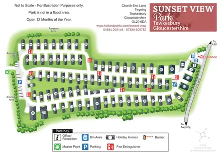
Numbered holiday homes, connected road loops and tree-lined amenity margins at Sunset View Park, Gloucestershire.
 Explore the map ↗
United Kingdom
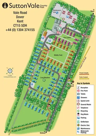
A tree-lined Kent holiday park map with colour-grouped accommodation, named areas and distinct public and private footpaths.
 Explore the map ↗
United Kingdom
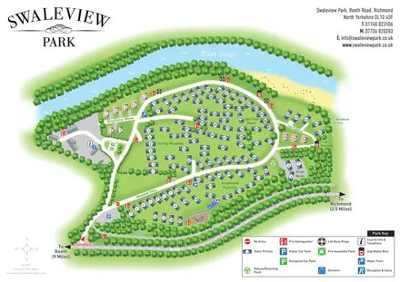
A numbered riverside holiday-home park plan with named neighbourhoods, wooded boundaries and a clear arrival route.
 Explore the map ↗
United Kingdom
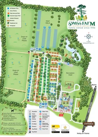
Portrait park map with colour-coded touring pitches, lakeside glamping and clearly grouped visitor facilities.
 Explore the map ↗
United Kingdom
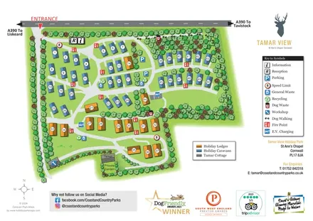
Tree-framed caravan and lodge park map with numbered accommodation, EV charging and a pawprint dog walking route.
 Explore the map ↗
United Kingdom
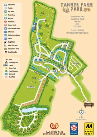
Colour-coded pitches, central facilities and woodland yurts on Tanner Farm Park's illustrated visitor map.
 Explore the map ↗
United Kingdom
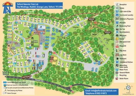
Woodland club map with colour-coded caravan pitches, camping, sports courts and named walking routes.
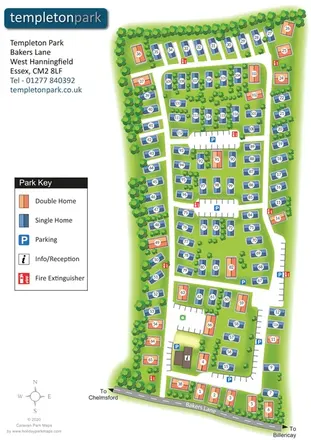 Explore the map ↗
United Kingdom
Templeton Park estate plan with colour-coded single and double homes, parking courts and a tree-lined boundary.
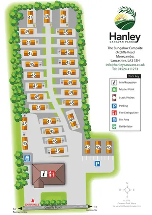 Explore the map ↗
United Kingdom
Tree-lined static-caravan park plan with a central access spine, entrance reception and Hanley branding.
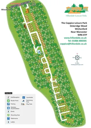 Explore the map ↗
United Kingdom
A diagonal woodland park plan with orange holiday homes, white access roads and integrated Hillandale branding.
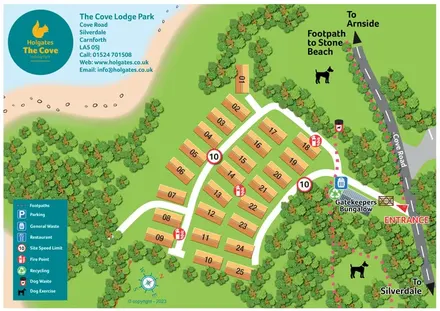 Explore the map ↗
United Kingdom
A coastal lodge park plan with numbered roofs, wooded margins and pink-dashed walking routes.
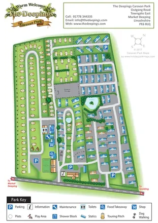 Explore the map ↗
United Kingdom
A mixed touring and static caravan park map with two ponds, a western dog-walking route and clearly grouped visitor facilities.
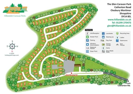 Explore the map ↗
United Kingdom
Tree-lined holiday-home rows and curving roads at The Glen Caravan Park, Shropshire.
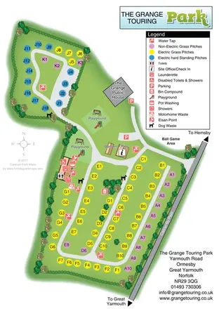 Explore the map ↗
United Kingdom
Colour-coded touring pitches, two playgrounds and a central facilities hub at The Grange Touring Park, Norfolk.
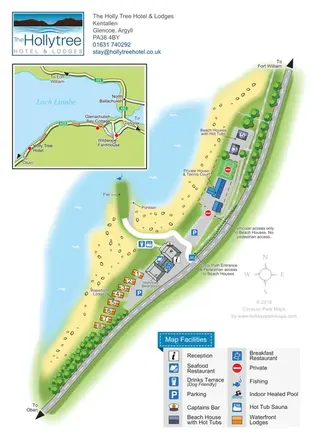 Explore the map ↗
United Kingdom
Lochside hotel and lodge map with colour-coded accommodation, separate access routes and a regional road inset.
 Explore the map ↗
United Kingdom
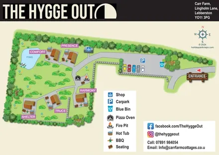
Five named glamping pods, private hot tubs and a shared fire-pit terrace in a landscaped countryside map.
 Explore the map ↗
United Kingdom
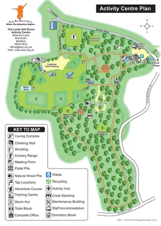
Illustrated Scout activity-centre plan with numbered camping areas, woodland routes and a comprehensive facility key.
 Explore the map ↗
United Kingdom
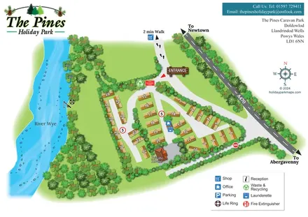
A compact riverside holiday-home map with numbered golden roofs, landscaped lanes and clear arrival landmarks.
 Explore the map ↗
United Kingdom
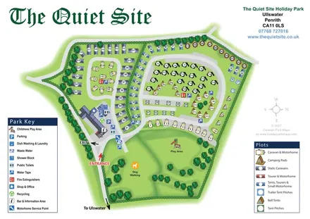
Illustrated Ullswater holiday-park map with mixed accommodation, two symbol keys and a spacious dog-walking and play green.
 Explore the map ↗
United Kingdom
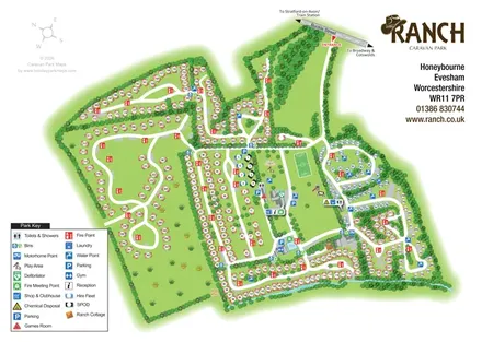
Illustrated Ranch Caravan Park map with looping accommodation roads, central leisure facilities and Gate Inn Brook.
 Explore the map ↗
United Kingdom
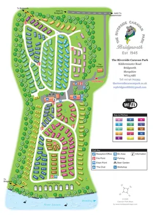
Colour-coded caravan plots, central facilities and riverside touring at The Riverside Caravan Park, Bridgnorth.
 Explore the map ↗
United Kingdom
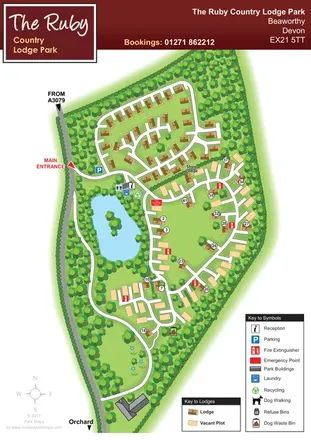
Wooded Devon lodge park map with a pond, branching roads and clearly differentiated vacant plots.
 Explore the map ↗
United Kingdom
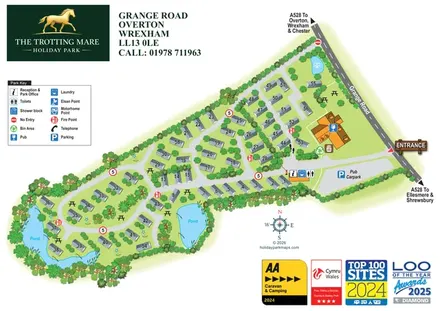
A landscape-led holiday park plan with numbered caravan-style homes, pond-side lanes and a clearly marked pub and reception area.
LET’S MAP YOUR PARK
For a map quotation, find your park and draw a rough boundary around it. The area you select helps us work out the design time and price.
Draw your park for a quote ↗Or talk to our map designers
01751 473136